Local Natural Wonders - Day 31
Local Natural Wonders Day 31 - Maquoit Bay Conservation Land in Brunswick, Maine
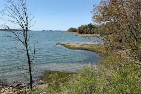
Maquoit Bay Conservation Land is a 124-acre preserve owned by the Town of Brunswick and protected through conservation easement with the Brunswick-Topsham Land Trust (BTLT). This land is comprised mostly of woodlands and some salt marshes. It has a mile-long looped trail for walking, snowshoeing or cross-country skiing along an old woods road, as well as gorgeous views of Maquoit Bay on the Maine coast. Where the trail meets the coastline, hikers will find Rocky Point, a unique rocky promontory. This location is an ideal spot for swimming at high tide in the warm waters of the shallow bay.
DIRECTIONS & TRAIL USE RESTRICTIONS FROM BTLT:
Directions to Maquoit Bay Conservation Land: from downtown Brunswick, follow Maine Street southeast for approximately 1.6 miles. Continue onto Mere Point Road for 0.2 miles and then bear right onto Maquoit Road. Follow Maquoit Road for 1.9 miles and then turn right onto Woodside Road. Follow Woodside Road for 0.5 miles and then take first left onto Bunganuc Road. Property is on the left in about 0.5 miles and has an established gravel parking area with road signage.
Trail Use Restrictions:
-
Open dawn to dusk
-
No off-road vehicles, bicycles, snowmobiles, or horses
-
On-leash dogs permitted (dog waste removal required)
-
No fires or camping
-
Stay on marked trails
-
Hunting permitted
-
Observe posted trail rules
0 comments
Leave a comment
Please log in or register to post a comment