Local Natural Wonders - Day 33
Local Natural Wonders - Day 33 - Mt. Agumenticus in Cape Neddick, Maine
From the Mt. Agamenicus Conservation Region website:
The Mount Agamenticus Conservation Region consists of more than 10,000 acres and is located within an additional 30,000 acre expanse of conservation land in southern Maine. This land is comprised of a rich and unique coastal forest that supports the highest diversity of animal and plant species in all of Maine. The mountain and the surrounding area provide residents with an ideal location for hiking, biking and sightseeing. While most of Southern Maine is heavily developed, this stretch of conservation land is a natural treasure that will be preserved for the enjoyment of generations to come.
Trail Information (from Maine Trail Finder):
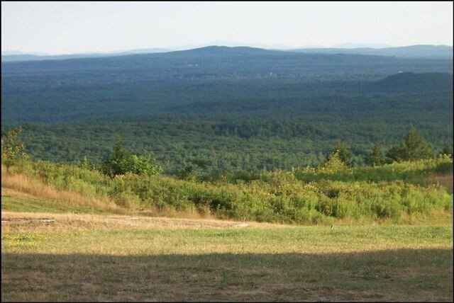
Turtle Loop (2.2 miles, moderate): The Turtle Loop includes a self-guided interpretive trail featuring 15 information stations highlighting many of the unique natural, geological, and cultural history of Mount Agamenticus. Start at Ring Trail located at the southern base parking area. Proceed up Ring 0.1 miles and turn left at intersection to cross summit road. Continue westerly passing Blueberry Bluff intersection. At 0.4 miles there is a scenic overlook that presents an unobstructed view to the West. Passing the overlook Ring Trail turns northerly and passes Wintergreen, Fisher, Vultures View and Sweet Fern intersections before reaching the half way point at Goose Foot/Chestnut Oak crossing. Continue on Ring for 0.15 miles and turn right onto Witch Hazel Trail. Climb 0.4 miles to the summit of Mount Agamenticus. After enjoying the summit views, continue back down Witch Hazel Trail and turn right back onto Ring Trail. Proceed southerly 0.7 miles past Rocky Road/Hairpin Trail crossing, a summit road parking area, and past the first intersection of your loop to return to the base parking area.
Bear Loop (3.2 miles, moderate-advanded): This loop utilizes old roads to run along old rock walls and abandon cellar holes. The route starts in a dominantly hemlock forest and changes to a mix forest of pine and oak old growth. Start at Cedar Trail located at western base parking area. Proceed 1 mile along Cedar Trail (passing Goosefoot which is the return trail) over three small boardwalk bridges. Turn right onto Porcupine Trail and proceed for about 1 mile, passing Second Hill intersection to Chestnut Oak Trail. Turn right onto Chestnut Oak and proceed 0.3 miles until it ends at Ring/Goosefoot/Chestnut Oak crossing. Take Goosefoot 0.7 miles back down hill, passing Vultures View Trail to Cedar. Turn left onto Cedar and follow 0.3 miles back to parking area.
Click Here for a trail map.
Click Here for directions.
0 comments
Leave a comment
Please log in or register to post a comment